

Abstract
Accelerated melting of glaciers is expected to have a negative effect on the water resources of mountain regions and their adjacent lowlands, with tropical mountain regions being among the most vulnerable. In order to quantify those impacts, it is necessary to understand the changing dynamics of glacial melting, but also to map how glacial meltwater contributes to current and future water use, which often occurs at considerable distance downstream of the terminus of the glacier. While the dynamics of tropical glacial melt are increasingly well understood and documented, major uncertainty remains on how the contribution of tropical glacial meltwater propagates through the hydrological system, and hence how it contributes to various types of human water use in downstream regions. Therefore, in this paper we present a detailed regional mapping of current water demand in regions downstream of the major tropical glaciers. We combine these maps with a regional water balance model to determine the dominant spatiotemporal patterns of the contribution of glacial meltwater to human water use at an unprecedented scale and resolution. We find that the number of users relying continuously on water resources with a high (>25%) long-term average contribution from glacial melt is low (391 000 domestic users, 398 km2 of irrigated land, and 11 MW of hydropower production), but this reliance increases sharply during drought conditions (up to 3.92 million domestic users, 2096 km2 of irrigated land, and 732 MW of hydropower production in the driest month of a drought year). A large proportion of domestic and agricultural users are located in rural regions where climate adaptation capacity tends to be low. Therefore, we suggest that adaptation strategies should focus on increasing the natural and artificial water storage and regulation capacity to bridge dry periods.
Export citation and abstract BibTeX RIS

Original content from this work may be used under the terms of the Creative Commons Attribution 3.0 licence.
Any further distribution of this work must maintain attribution to the author(s) and the title of the work, journal citation and DOI.
1. Introduction
Global climate change is accelerating glacial ablation in many mountain regions of the world, generating concerns about the impact on local and regional water resources (e.g. Kaser et al 2010, Bradley et al 2006, Barnett et al 2005) for a number of reasons. Mountains contribute disproportionally to global water resources compared with their geographical extent, and are therefore often described as natural water towers. In arid and semiarid regions in particular it is estimated that between 50% and 90% of freshwater resources originate from mountain catchments (Messerli et al 2004). Additionally, many mountain regions already face high environmental pressures such as deforestation and land degradation, which often have detrimental impacts on water resources (e.g. Viviroli et al 2011).
These issues are particularly pronounced in tropical regions, many of which are undergoing accelerated environmental change in conjunction with data scarcity and limited local adaptation capacity. In addition, tropical glaciers are highly sensitive to climate change because they maintain a more constant temperature regime throughout the year (Rabatel et al 2013), and small changes in temperature can strongly perturb the glacial mass balance (Francou et al 2000).
Over 99% of tropical glaciers are located in the Andes, where glaciers provide a buffer for highly seasonal precipitation regimes (Kaser et al 2010). The rate of melting of Andean glaciers has increased since 1970 and has been linked to warmer climate conditions (Bradley et al 2006). Recent observations show that daily maximum temperatures between October and May in the upper Andes well exceed the freezing point, even at altitudes above 5680 m (Bradley et al 2009). Under the currently available climate change projections it is therefore expected that glacial mass loss will continue in future decades, and that several smaller glaciers will disappear completely (Vuille et al 2008, Rabatel et al 2013).
Glacial mass loss is increasingly well documented for the tropical Andes. Recent regional overviews are given by Vuille et al (2008) and Rabatel et al (2013) and these show a general trend of retreat since the mid-20th century, which has been accelerating since 1970, reaching rates that have been unprecedented since the period of maximum extent during the Little Ice Age. This has led to widespread and increasing concerns about the potential impact of glacial melting on the water resources of the tropical Andes and the social and economic vulnerability of the population (e.g. Bradley et al 2006).
However, despite these significant research efforts to characterize the dynamics of tropical glacial melt, major uncertainty remains on how the contribution of tropical glacial meltwater propagates through the terrestrial water cycle, and how it contributes to various types of human water use downstream. This is a necessary precondition for identifying spatiotemporal dynamics and hotspots of human vulnerability. Several studies exist for individual basins, such as the Río Santa in Peru (Baraer et al 2009) and the water supply system of La Paz, Bolivia (Soruco et al 2015). Existing studies show a high diversity in river response, which results from the specific interaction between glacial dynamics, climate characteristics and catchment hydrology. A similar spatial heterogeneity was found by Kaser et al (2010), who globally characterized spatial patterns of the contribution of glacial melt by comparing glacial melt inputs with precipitation patterns in glaciated basins around the world. However, this study did not include a hydrological analysis to understand how these inputs propagate through the terrestrial water cycle and interact with other processes of hydrological regulation such as soils and groundwater aquifers. Given that most human water use occurs at a distance from the glaciers, this is paramount for understanding and quantifying human dependence on glacial meltwater, and the potential impact of perturbations such as climate change.
Schaner et al (2012) addressed this issue by using a global implementation of the hydrological model VIC to quantify the contributions of glacial meltwater to streamflow, and to identify the population living in river basins with large glacial contributions. However, the coarse spatial resolution and global scope of their modelling setup did not allow a fine-grained analysis of the spatiotemporal patterns of this contribution to actual human water use.
In this study, we advance the state of the art in two directions. First, we couple the glacial melt model developed by Kaser et al (2010) with a water balance model for the tropical Andes to analyse propagation of glacial melting at unprecedented spatial resolution (1 km). Subsequently, we create previously non-existing regional maps of water demand for the tropical Andes at high resolution (100 m) and use them to identify hotspots of human dependence on glacial meltwater in the study region.
2. Methods
We coupled a monthly glacial melt model with a regional water balance model of the tropical Andes and combined it with high-resolution (100 m) spatial data on water use for irrigation, hydropower and human consumption in Ecuador, Peru and Bolivia. Colombia, Venezuela and northern Chile were excluded from the analysis because of negligible glacial contributions.
Quality-controlled precipitation data were obtained from the national meteorological networks of Ecuador, Peru and Bolivia for the period 1970–2010. Stations with >90% data availability were retained, giving a total of 269 stations. These data were used to calculate monthly climatologies and monthly averages for a drought year with return period of 10 years at a national level. We chose 2005 for Ecuador and 1988 for Peru and Bolivia. Subsequently the point precipitation data were interpolated spatially using co-kriging with the TRMM 2A25 average monthly precipitation product as a co-variable, yielding high-resolution (5 km) monthly climatology maps. Further details of the interpolation procedure, performance assessment and discussion of uncertainties are given in Manz et al (2016). Average monthly temperature maps were obtained from the global WorldClim climatological dataset (Hijmans et al 2005), which has a resolution of 1 km and incorporates elevation as a co-variable. The same temperature maps were used for both the average and dry scenario runs because of the low interannual variation in temperature in the study region. Monthly average reference evapotranspiration maps were calculated using the FAO Hargreaves method (Allen et al 1998). These maps were converted into potential evapotranspiration maps using a vegetation coefficient for vegetation classes obtained from the ESA GlobCover land-cover product. The vegetation coefficients and routing module were calibrated regionally using monthly river flow from 89 Peruvian and Ecuadorian river gauging stations.
The water demand data were compiled from various government resources. Hydropower locations and generation potential were obtained from national government sources (Ministry of Electricity and Renewable Energy, Ecuador; Ministry of Energy and Mines, Peru; and the Bolivian Government's Geoportal GeoBolivia). A high-resolution irrigation map for Peru was compiled by spatially disaggregating district-level statistics of irrigated area from the Peruvian national agricultural census databases using agricultural area maps obtained from the national water authority (ANA). For Ecuador, irrigation abstraction data were available from the national water secretariat (SENAGUA), and the Ministry for Environment and Water (MMAyA) in Bolivia. These same sources provided data for water abstraction points for cities and urbanizations. Data on water abstraction for domestic use in rural regions are typically not available because many are informal or poorly documented. Therefore, we generated a rural population map by masking cities from the 1 km population density map of the Global Rural-Urban Mapping Project, version 1 (CIESIN 2013). This map was rescaled to match 2010 population densities. We then developed an allocation routine in order to identify the most likely abstraction point for these populations. For each spatial pixel of the population map, the abstraction point was allocated to the nearest river or lake pixel located at an elevation equal to or above the elevation of the pixel of consumption. The latter allows for water transport by gravity. In regions where transport using pumps is known to take place, an elevation difference of 25 m was allowed for. The same allocation method was used for the irrigated area map for Peru.
Our glacial melt model is based on the mass budget model published by Kaser et al (2010). This model assumes that the glaciers are in long-term equilibrium with climate. This will most likely underestimate current glacial contributions because it neglects accelerated melting, but we believe that this provides a useful baseline and that resulting errors are negligible compared with other errors (see the uncertainty analysis below). For monthly accumulation onto the glacial surface we used the interpolated precipitation maps. Monthly ablation is calculated by distributing the total annual accumulation over the months for which the temperature at the elevation of the glacial terminus is above freezing, proportional to the temperature above zero (see Kaser et al (2010) for further details about the calculations). We updated this model by using the Randolph Glacier Inventory version 4.0 (Pfeffer et al 2014) for the glacial extent, and the Shuttle Radar Topography Mission for elevation. Additionally, although the original model does not account for sublimation, we used a spatially lumped average sublimation rate based on empirical studies in the area. We account for uncertainties in this estimate in the uncertainty analysis (see below).
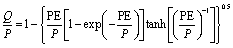
We used a water balance model to represent the catchment hydrology, which is a more robust approach than the more typical rainfall-runoff modelling because of very large uncertainties in gridded precipitation time series for this region (Zulkafli et al 2014). The Budyko water balance model as described by Oudin et al (2008) was used to partition calculate average monthly runoff (Q) from average precipitation (P) and potential evapotranspiration (PE):
with all variables in the same dimensions (mm month−1). To account for subsurface drainage, non-glacial runoff was routed using a linear reservoir. The time constant of the routing model was calibrated together with the vegetation coefficients against observed flows and magnitude by minimizing the root mean squared error combined with visual inspection. Discharge data were obtained from the hydrometeorological offices of Peru (SENAMHI) and Ecuador (INAMHI). These data are typically the result of water level measurements converted to discharge using empirical rating curves.
The linear reservoir time constant was regionalized using a linear relationship with elevation identified by regression analysis, to route surface runoff along the river network. Glacial melt runoff was routed along the river network without time delay, assuming that most glacial melt consists of surface runoff or shallow subsurface runoff with a residence time much less than 1 month. In order to obtain the relative glacial contribution along the river network, the ratio of glacial runoff to non-glacial runoff was calculated for each pixel of the river network.
Artificial reservoirs were only accounted for if their main purpose is regulation, assuming full seasonal regulation, i.e. filling during the wet season and emptying during the dry season. Reservoir locations were obtained from the Global Reservoir and Dam (GRaND) database of the Global Water Systems Project (GWSP). Water abstractions were not taken into account because of their limited impact on the glacial melt mixing factor. One inter-basin transfer scheme was included, i.e. the Marca III scheme, which transfers 120 × 106 m3 year−1 to the Santa Eulalia river near Lima.
An uncertainty analysis was implemented to account for the major sources of error. We assumed that uncertainties in the water use data are negligible because of the reasonably good quality and high level of disaggregation of government statistics, and therefore focussed our uncertainty analysis on the water balance model and the glacier model. The water balance model was evaluated by comparing simulated discharge with the SENAMHI and INAMHI river discharge records of non-glaciated basins with at least 50% data availability over the studied period (1971–2000). Because of a lack of metadata such as stage–discharge curves we did not account for uncertainties in the discharge observations themselves except for eliminating stations with unrealistic data. We took the monthly maximum absolute error between the simulated and observed runoff as the uncertainty limit, which is more robust and conservative than the root mean square error. For the glacial melt model we varied the sublimation fraction between 0 and 0.2, which is the typical range of observed fractions in this region (Wagnon et al 1999, Mark et al 2005). We assume that this range also encompasses additional uncertainties related to the assumption of glacial mass equilibrium. The total uncertainty limits of the contribution of glacial melt were calculated by combining, respectively, the minimum (maximum) estimate of river flow with the maximum (minimum) estimate of glacial melt.
To assess the magnitude of interannual variability, we ran our model with average precipitation and temperature data for the period 1971–2010, and with data for a representative drought year with a return period of 10 years at a national level (2005 for Ecuador and 1988 for Peru and Bolivia). For both scenarios, the annual average and monthly maximum contribution of glacial melt is reported as an indicator of intra-annual variability of the contribution of glacial melt.
Lastly, as a summary statistic, we use a threshold of 25% meltwater contribution to define 'high' dependence. This is necessarily an arbitrary choice, but provides a benchmark for comparison.
3. Results and discussion
3.1. Spatiotemporal persistence of the glacial melt signal
Figures 1 and S1–S3 (supplementary material available at stacks.iop.org/ERL/12/114014/mmedia) show the spatial propagation of the contribution of glacial melt in the vicinity of the major glacial complexes in the study region. Full regional maps are given in figures S4–S7 online (see supplementary material). A very high spatial variability can be observed. At a regional scale, the contribution of glaciers that drain towards the humid slopes of the Amazon basin (e.g. the Vilcanota range and the Quelccaya ice cap) tends to decrease rapidly with downstream distance (figure 2). This is caused by high contributions of lateral runoff of non-glacial origin, generated by orographic precipitation along the eastern slopes of the Andes (Bookhagen and Strecker 2008).

Figure 1. Spatial propagation of the contribution of glacial melt to river flow for four hotspots in the tropical Andes: maps show the annual average during a normal year; similar maps for the monthly maximum and a drought year are given in figures S1–S3.
Download figure:
Standard image High-resolution image
Figure 2. Longitudinal profile of the contribution of glacial melt and water use for irrigation and domestic water use for the Santa and Vilcanota rivers in Peru. Water use data are smoothed with a moving average of 1 km and the y-axis limits are restricted to increase readability. Water intakes that exceed the y-axis limit are highlighted: intake for (a) the Chavimochic irrigation scheme, (b) the city of Trujillo, (c) the city of Chimbote, and (d) coastal settlements.
Download figure:
Standard image High-resolution image
In contrast, the meltwater signal of glaciers located in the arid and semi-arid Pacific basins and the altiplano highlands of South Peru and Bolivia show a much stronger spatial persistence. A notable example is the Santa river basin, which drains the glaciers from the Cordillera Blanca mountain range in Peru. Because of the arid climate of the Pacific slopes, the Santa river receives minimal lateral contribution and the glacial signal contribution is maintained along its longitudinal profile until the river's outlet in the Pacific Ocean (around 6.2% on average, increasing to 26.5% during drought years; figure 2).
The seasonal variation in the contribution of glacial melt (figures 2 and S4–S7) is very pronounced in the entire study region. This is caused by the high seasonality of the precipitation regime in most of the tropical Andes (e.g. Garreaud 2009). On the other hand, the low seasonal amplitude of temperature favours year-round glacial melting. In some regions such as the Santa region, the synchronicity of maximum ablation with the dry season further enhances the seasonal variation of the contribution of glacial melt (Kaser et al 2010).
3.2. Glacier melt contribution to human water use
The contribution of glacial meltwater to water used for human activities is a function of both the spatial persistence of the meltwater signal and the spatial configuration of human water use. As high mountain regions tend to be sparsely populated, most water use occurs at a considerable distance from the glaciers, where the meltwater signal may be diluted. Compared with most mountain regions, the tropical Andes has a high population density, with major cities such as Quito and La Paz being located at high elevation. Nevertheless, full country statistics about the contribution of glaciers to different types of water use (table 1 and figure S8) reveal that the majority of water use from rivers influenced by glacial melt is located in regions where the average contribution of meltwater to surface water resources is less than 10%—this includes the capitals of Ecuador (Quito, 2.2%) and Peru (Lima, < 1%). The main exceptions are the urban conglomerate of La Paz and El Alto in Bolivia, which receives on average 14.8% (5.9%–26.8%) and Huaraz in Peru, which receives 19.0% (7.5%–53.4%).
Table 1. Relative contribution of glacial melt (%) to the water supply of selected cities under different meteorological conditions. Values in square brackets indicate the uncertainty ranges of the estimates.
| Quito | Lima | La Paz | Huaraz | |
|---|---|---|---|---|
| Annual average (normal year) | 2.2 [0.9–5] | <1.0 [0–1] | 14.8 [5.9–26.8] | 19.0 [7.5–35.4] |
| Monthly maximum (normal year) | 5.3 [2.3–11.1] | 1.17 [0–2.7] | 61.1 [37.8–77.1] | 67.3 [41.9–82.8] |
| Average annual (drought year) | 3.7 [1.5–8] | <1.0 [0–1] | 15.9 [6.4–29.4] | 27.2 [11.6–46.7] |
| Monthly maximum (drought year) | 15.4 [7.3–27.6] | 4.15 [0–9.1] | 85.7 [74.1–91.5] | 91.1 [78.1–96] |
Table 2. Estimated water uses with >25% glacial melt contribution under different meteorological conditions. Values in square brackets indicate the uncertainty ranges of the estimates. 'Normal year' refers to the average precipitation and temperature conditions over the period 1971–2010. Meteorological conditions of a drought year were taken from a representative drought year with a return period of 10 years at a national level (2005 for Ecuador, 1988 for Peru and Bolivia).
| Domestic users | Irrigated area (km2) | Hydropower (MW) | |
|---|---|---|---|
| Annual average (normal year) | 391 000 [67 500–1 530 000] | 398.2 [79.6–632.7] | 11 [0–298] |
| Monthly maximum (normal year) | 2 320 000 [1 830 000–3 170 000] | 1231.0 [782.6–1921.9] | 582 [308–673] |
| Average annual (drought year) | 626 000 [180 000–1 590 000] | 546.0 [397.5–794.3] | 275 [264–308] |
| Monthly maximum (drought year) | 3 920 000 [3 050 000–5 040 000] | 2096.5 [1857.3–2452.4] | 732 [308–762] |
Our results for the city of La Paz are in very good agreement with one of the few existing local studies on the contributions of glacial melt (Soruco et al 2015), which estimates an annual glacial contribution of ~15%.
Contributions to surface water used for agricultural purposes vary more widely (table 2). A total of 398 km2 (79.6–632.7 km2), representing 1.7% (0.3%–2.7%) of the studied countries' total irrigated areas, receives a glacial melt contribution of over 25% on average. Most of this area (72%) is located in Peru and consists of predominantly small-scale upland farms in the Andes. Of the large-scale agricultural irrigation areas in the Peruvian coast, the Chavimochic scheme (458 km2) receives the largest contribution (6.8% on average, increasing to 52.1% during extreme droughts).
Lastly, the tropical Andes hosts major hydropower schemes, for a total capacity of, respectively, 2.41 GW (Ecuador), 4.19 GW (Peru), and 494 MW (Bolivia) (World Energy Council 2017). Many of these schemes are located in glacier-fed basins, such as the storage-based Cañon del Pato plant (264.4 MW) on the Santa river and the Zongo system in Bolivia, with a total capacity of 188 MW. As for human and agricultural consumption, only a small fraction of an estimated 11 MW (0–298 MW) receives a large input (>25%) of glacial meltwater, though this increases dramatically to an estimated 732 MW (308–762 MW) during extreme drought conditions (table 2).
3.3. Implications for the vulnerability and management of water resources
The impact of environmental change on water resources and the resulting vulnerability of local populations is the result of a complex interaction of natural and socio-economic factors (Bury et al 2011). Therefore, our maps of the contribution of glacial melt cannot be used as direct guidance to identify hotspots of human vulnerability; yet our results provide some insights that may be useful for guiding future management of water resources, in particular in the context of climate change.
Many parts of the Andes already experience water stress. The rural Andean highlands of southern Peru and Bolivia are thought to be particularly vulnerable, because of the arid climate, frequent occurrence of droughts and endemic poverty (e.g. García et al 2007). This is further exacerbated by the low hydrological storage capacity of the small upland catchments, resulting in low base flows in rivers and low groundwater availability (e.g. Buytaert et al 2011). In these conditions glacial melt can be a major buffering mechanism. Out of the 2.3 (1.8–3.1) million people consuming surface water with over 25% glacial melt during at least 1 month during a year with average rainfall, our model identifies 725 000 people in rural areas (1.3% of the total population of Ecuador, Peru and Bolivia). These are typically small communities at risk of poverty and with limited capacity for adaptation (Bury et al 2011). During extreme drought, this number increases to 1.08 million (2.0% of the total population of the studied countries). In addition to domestic consumption, these populations are also likely to rely on water for agricultural use to support their livelihoods.
In contrast, large cities already cope with seasonal variation in streamflow by means of water storage infrastructure. For instance, Lima has a water storage capacity of 190 × 106 m3 formed by a network of interconnected lakes and reservoirs, which limits the seasonal variation of the glacial contribution (table 1). Quito and La Paz have similar infrastructure. In these systems, glaciers may still provide significant inter-annual buffering capacity. During drought conditions the glacial contribution to water supply for the city of Lima increases in certain months up to 4.15% (0%–9.1%), and up to 91.1% (78.1%–96.0%) for La Paz/El Alto (table 1). The resilience of the water systems of these cities will therefore be determined by the capacity for such inter-annual storage capacity to cope with future change.
Future changes in streamflow will depend on the rate of decrease of glacial mass as well as the impact of other hydrological change, and in particular the direct impacts of climate change on water resources. Future equilibrium conditions of glaciers are controlled by the properties of glaciers, and local trends in precipitation, temperature, radiation and air humidity. As such, future trends in glacial equilibrium are strongly linked to projected climate trends, which show strong divergence over the tropical Andes (figure S9).
The impact of a future reduction of glacial area on total catchment water yield is expected to be negligible in all but the highest parts of the Andes because of the small fraction covered by glaciers. In contrast, a reduction in seasonal buffering capacity will have a more severe impact, particularly because of the projected increases in seasonality of precipitation under future climate conditions (e.g. Urrutia and Vuille 2009). These trends stress the importance of increased water storage capacity as a pathway for climate adaptation. Because of the challenges and cost related to artificial storage efforts, novel solutions such as green infrastructure to promote water infiltration and natural storage capacity are gaining traction (e.g. Gammie and De Bièvre 2005). From the perspective of climate adaptation it will be paramount that their potential is maximized.
Lastly, the tropical Andes are a region with a strongly increasing water demand. The studied countries have population growth rates between 1.5 and 2.8%, with cities typically growing faster than national averages (Buytaert and De Bièvre 2012). The water demand from industry and large-scale irrigation is growing, particularly in the Peruvian coast, and so is hydropower production. Over the next 20 years, 151 new hydropower projects with a production of more than 2 MW are planned (Finer and Jenkins 2012). Irrespective of changes in supply, these trends will be dominant drivers of increased pressure on water resources, and should therefore be a focus for future research.
4. Conclusions
Accelerated glacial melting in the tropical Andes has caused widespread concern about the vulnerability of the region's water resources to climate change. Although the dynamics of glacial melting are increasingly well documented in the scientific literature it is not well understood how this signal propagates through the catchment hydrological cycle and contributes to water used for human activities. Based on high-resolution hydrological modelling and mapping of water use, we find that average glacial contributions for most water uses are low, and only a relatively small number (391 000 domestic users, 398 km2 of irrigated land, and 11 MW of hydropower production) rely on a high (here defined as >25%) contribution of glacial melt. However, these are mostly rural populations which are thought to have limited adaptation capacity. Additionally, this reliance increases sharply during drought conditions (up to 3.92 million domestic users, 2096 km2 of irrigated land and 732 MW of hydropower production in the driest month of a drought year), highlighting the need for inter-annual storage capacity. Therefore, current efforts to improve this capacity, through both traditional engineering and more novel methods such as green interventions, should be promoted. Our results are a necessary step to map hotspots of vulnerability, which is needed to design and target future interventions. Lastly, we find large uncertainties in our estimates, which are mostly the result of uncertainties in the glacier and hydrological models. These highlight the need for further data collection and process understanding.
Acknowledgments
This research was supported by a grant from the Grantham Institute for Climate Change at Imperial College London (SM, WB), UK NERC contracts NE/K010239/1 and NE/I004017/1 held by WB, and the Ecuadorian Government (SENESCYT Prometeo programme held by WB).
ORCID iDS
Wouter Buytaert https://orcid.org/0000-0001-6994-4454
Marcos Villacis https://orcid.org/0000-0002-4496-7323